Seeking cooler weather in the insufferable Japanese summer, I spent this year’s Obon week (a traditional holiday in the middle of August) in the Tohoku region of northern Japan. Weather was hot initially, but then, thanks to a typhoon passing over Western Japan, most days were thankfully much cooler.
Below is a description of my itinerary, a total drive of 1,250km in one week. If you have any questions, please feel free to leave a comment here, or email me.

Day 1: Yamagata Prefecture > Sendai
Day 2: Sendai City
Day 3: Miyagi Prefecture to Iwate Prefecture
Day 4: Iwate Prefecture > Akita Prefecture
Days 5-6: Akita Prefecture
Day 7: Akita > Aomori Prefecture
Day 1: Yamagata Prefecture to Sendai
I flew from Itami aiport in Osaka to Sendai airport, picked my rental car, and headed west to Yamagata Prefecture. In the first half day I visited two spots there:
Yamadera. In the mountains to the north of Yamagata City is Yamadera, a small village famous for the eponymous Buddhist temple located up in the mountain overlooking the village. The temple (official name: Risshakuji) is more than a thousand years old, and to get to it one needs to climb about 1,000 stairs. The temperature down in the valley was higher than 30c, but the stairs wind up through a thick forest so the temperature drops somewhat (unfortunately the humidity does not).
The most essential item here in summer (after liquids) is a small towel, to wipe the sweat off the face every minute or so, while uttering desperate cries of atsui ne! (“it’s hot, isn’t it?”). I forgot my small towel in the car but bought one in a gift shop before starting the climb. The heat and humidity made me think about deserting halfway to the top, but I looked around and saw a multitude of octogenarians climbing stoically beside me, so I didn’t dare give up… There are several other temples along the way, as well as an interesting rock formation into which visitors wedge coins.
The climb is worth it. Although the temple itself is not overwhelming (aside from its old age), the view of the valley from Godaido Hall, an open wooden terrace at the top, is breathtaking. Unhindered by any building or trees, the breeze up there is also a most welcome bonus after the climb.

Statuettes at Yamadera

The climb up to Yamadera

Coins inserted into the rock

Yamadera village – View from Yamadera temple
Ginzan Onsen. Further north is the onsen (hot spring) town of Ginzan (“silver mountain”), so named after a silver mine that used to operate here. The center of this tiny town is a pedestrian-only area, and is very picturesque. Old wooden houses, most of them ryokans (Japanese-style hotels) and restaurants line up the sides of the main street, at the center of which runs a small, steaming stream.
My intent was to soak in one of the two public baths here. But I arrived a few minutes before 5pm, only to find out that the baths close at 5pm… What a disappointment! I had to make do with the foot bath in the center of the town. As dusk approached, the gas lights along the street lit up, and the ryokan guests strolled up and down in their yukatas (traditional robes) and gettas (wooden sandals) searching for a place to have dinner. It must be extra beautiful here in winter, when the entire place is covered in snow.

Ginzan onsen entrance

Ginzan onsen view

An old building at Ginzan onsen
When done at Ginzan Onsen, I retraced my route back to Sendai, to arrive at my hotel in the center of the city.
Day 2: Sendai City
Sendai is the major city in Miyagi prefecture. With a population of just over 1 million, it is the 2nd largest city north of Tokyo. The first thing that strikes a visitor is the number and size of trees that line up the main avenues in the center of the city. These majestic zeikova trees have given Sendai the nickname mori-no miyako (“city of forest/trees”). In summer, Sendai is most famous for the Tanabata Festival, but I missed it by one week so I spent the day taking in the major sightseeing sites.
AER Building Observatory. After my morning coffee at the beautifully decorated Tullys Coffee in front of Sendai Station, I crossed the street to take the elevator up to the 31st floor of the AER building, which is next to the station. The free observatory offers views of the city from high up in three directions, so it’s a good way to start (or end) the exploration of the city.

AER building

View of shinkansen tracks from AER building
Daikannon Statue. Standing at 100m northwest of the city, the Daikannon Statue is a permanent feature of Sendai. Because it’s on a hill, you can see it from almost anywhere in the city. Kannon (or Guanyin in Chinese) is a Buddhist female bodhisattva, revered throughout Asia. This godzilla-sized white statue (purportedly the 6th tallest statue in the world) holds a water flask in her hand (symbolizing the water of wisdom) and what looks like a ball in the other hand. Most bizarrely, the necklace around her neck is the Magen David (Star of David), an hexagram which later became the symbol of Judaism (and appears on the flag of Israel). People who wish to get married come to Kannon to pray, and behind the statue is a small temple where they hang up their wishes for a good partner.

Daikannon statue

Entrance to Daikannon statue

Prayers for marriage
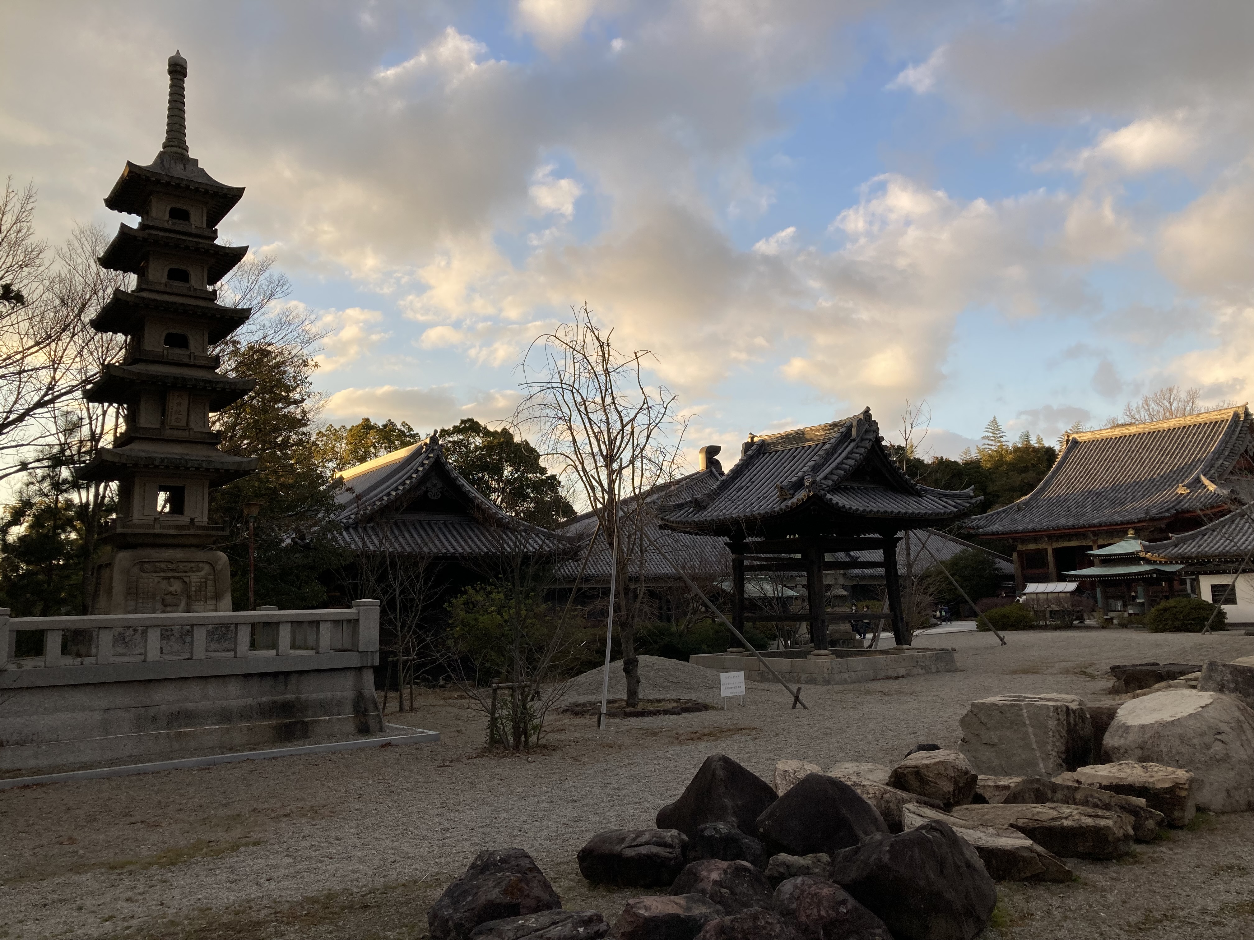
Rinnoji Temple. Not to be confused with the eponymous temple in Nikko, Sendai’s Rinnoji temple boasts a beautiful Japanese garden and a pagoda. Founded in the 15th century by the Date clan (that ruled the area for a long time), it is a great place to wander around and relax from the bustle of the city.

Rinnoji temple

At Rinnoji temple

The bell at Rinnoji temple
Osaki Hachimangu Shrine. Moving from Buddhism to Shinto, the Osaki Hachimangu Shrine was also founded by the Date clan, highlighting the laissez-faire attitude of Japanese theology (basically, anything goes). Hachiman is the deity of war and therefore the protector of the city. The shrine is lacquered in vivid colors, and some of the omikuji (fortune-telling papers) sold here are black, something I’ve never seen before. There was a practice going on for some ritual, with musicians, singers and beautifully-clad dancers.

Entrance to Osaki Hachiman shrine

Dancers practicing at Osaki Hachiman shrine

Daruma dolls at Osaki Hachiman shrine
Jozenji-Dori / Ichibancho. Back to the center of the city, I took a walk after lunch through the main thoroughfares and shopping streets. As in many other Japaneses cities, these covered shoten-gais (shopping streets) run for several blocks and intersect with each other, making it a shopping heaven for locals and visitors alike. With an approaching typhoon threatening Western Japan, the weather had cooled down considerably, so walking around was quite pleasant considering this is mid-August in Japan…

A barber shop that will make you handsome

Entrance to a shop at Ichibancho

Segafredo cafe at Ichibancho
Zuihoden. The founding feudal lord of the aforementioned Date clan, Date Masamune, built a mausoleum for his family in Sendai, called Zuihoden. Several buildings and burial sites dot this hillside complex and it was a fitting end to my day of wanderings in Sendai.

Entrance to Zuihoden

At Zuihoden grounds
Day 3: Miyagi Prefecture > Iwate Prefecture
Got up early today to head north, as I knew there would be a lot of driving to do. It was cloudy with the occasional downpour (Sendai got the northern “side” of they typhoon).
Matsushima Bay. Just outside Sendai, on the Pacific coast, lies Matsushima Bay. The bay has many small, forested islets and the view from the shore is so beautiful that it’s been voted as one of Japan’s top three scenic views (alongside Miyajima in Hiroshima, and Amanohashidate in Kyoto). Cruises that tour the bay are available, but I didn’t have time for that (and it was cloudy and foggy anyway), so instead I walked across a small bridge (reconstructed after the 2011 tsunami) onto Oshima Island. As I was there early I had this island to myself and took a leisurely walk among the pine trees to take photos of the bay.
Matsushima itself is a pretty touristy, with many shops and restaurants (and Chinese tourists). The symbol of this small town is the Godaido Buddhist temple, easily accessible from the main street. The temple contains five statues, but these are apparently displayed to the public only once every few 33 years for some obscure reason. Surprisingly, the temple – which is located on an exposed islet – did not suffer any major damage during earthquake and tsunami.

Bridge to Oshima island

Matsushima bay

Matsushima bay

Lanterns at Godaido temple
Ishinomaki. This medium-sized city has nothing to offer to tourists, but it became a symbol of the 2011 Tohoku earthquake and tsunami. I drove up to Hiyoriyama Park, that overlooks the coastal area where the massive tsunami waves came in. It is a huge construction site, although new bylaws prevent the building of houses there (only businesses). Unbeknownst to me, this was to be a preview of what I would see during the entire course of the day, while driving from Miyagi to Iwate: kilometer after kilometer of construction sites, to rebuild the incomprehensible damage caused by this natural disaster, that claimed the lives of more than 18,000 people and caused life-changing traumas to countless more.

View from Hiyoriyama park

Construction at Ishinomaki bay
Okawa Elementary School. Perhaps the most remembered tragedy of the tsunami is the Okawa Elementary School, located north of the city. It saw the deaths of more than 80 pupils and their teachers, who were covered by the waves of the tsunami that struck on March 11th, just after 3:30pm. Last year I read the book ‘Ghosts of the Tsunami’, by British journalist Richard Lloyd Parry, which tells the story of this tragedy and its aftermath (the families, the legal battle for compensation). Many believe that the children could have been saved, had the teachers led them up the hill behind the school after the earthquake struck and before the tsunami wave arrived. The gutted school building remains standing, as an overbearingly sad memorial to the young souls that were lost here.

At Oakawa elementary school

Stools in a classroom

Blackboard and flowers

Statue erected on the grounds of Oakawa elementary school
Kesennuma. Another symbol of the 2011 tsunami is the fishing port city of Kesennuma, which sustained heavy damage and is still being rebuilt. Many ships were carried inland here by the unstoppable force of the tsunami wave. I stopped here to walk around the port area and have a coffee at the iconic K-Port Cafe. This restaurant-cafe was founded by famous Japanese actor Ken Watanabe (‘The Last Samurai’, ‘Godzilla’, ‘Transformers’), to support the resurrection of Kesennuma from the devastation of the tsunami. It was designed by renowned Japanese architect Toyo Ito. Letters from Watanabe are displayed in the cafe, for patrons to read. To the north of Kesennuma is Mount Anbasan, which offers nice views of the city and the port.

K-Port cafe at Kesennuma

Kesennuma port after the reconstruction

Kesennuma from mount Anbasan
Miracle Pine. Further up north, near the small city of Rikuzentakata, stands a lone pine tree, dubbed the ‘Miracle Pine’. The city was basically wiped off the map by the tsunami, and it is now being rebuilt but raised by about 10 meters. The shore had more than 70,000 pine trees, and this one tree was the only one that survived the power of the waves. Standing 27 meters tall, the tree died about two years after the tsunami, and was preserved and reinstalled as a symbol of perseverance and hope. It now stands surrounded by a vast area of reconstruction, and many tourists walk the nearby road to take a look at this tree.

The Miracle Pine amid the reconstruction
Goishi Coast. My last stop for the day, before spending the night near Ofunato, was Goishi coast. An observation area provides stunning views of the rocky waterline, with the waves rushing in between the rocky formations and creating a marvelous combination of views and sounds.

Goishi coast

Goishi coast
A note about driving in this area of Tohoku. Because of the tsunami, old roads are being repaved and new roads are being paved. This means that navigation systems that rely on periodic map updates are quite useless. My car had such a system, and after a while I realized I need to check the itinerary with Google Maps, which is much more up to date. For example, the main route going north from Miyagi through Iwate is route 45, but now there’s a new expressway (E45), which runs more or less in parallel, and is toll-free.
Day 4: Iwate Prefecture > Akita Prefecture
Started early again today, as I was planning another long driving day along the Sanriku Coast, famous for its scenic views, especially cliffs overlooking the Pacific Ocean. Turned out to be shorter than expected, reason below.
Jodogahama Beach (Miyako). Driving up the coast from Ofunato, I reached Miyako, another name many recall from the news in 2011. I headed to Jodogahama beach, which is a forested area which has several short hiking paths, that lead to observation points and to the beach itself, which is mostly a pebble beach. It was quite foggy so the view was partial. There is a boat cruise that takes you to a ‘blue cave’ and offers views of the cliffs from the ocean, but there were many people waiting so I gave it a pass.

Wall built to contain tsunami waves

Jodogahama beach

Overlooking foggy Jodogahama beach
Kitayamazaki Coast. The shoreline north of Miyako is famous for its cliffs, so I headed to the first one: Unosu Cliff. There’s a car park south of the cliffs, and then a 15-minute walk though the forest to the observation deck. When I got there, this was the view:
It was then I realized that this was not the day to see Kitayamazaki Coast… I gave up on my drive north, and instead headed west.
Ryusendo Cave. About an hour from the coast is the town of Iwaizumi, famous for its limestone caves. Ryusendo is the largest of them, and one of the most impressive caves in Japan. It is a labyrinth of caverns that run deep into the rocky mountain. Only a short section is open to the public, and the public turned out in droves to see it. The temperature inside drops to around 10c, a welcome relief from the heat outside, but it quickly becomes quite chilly. The 700 meter long path inside the mountain is at times very narrow and at times quite wide. The most interesting feature are the three underground ‘lakes’ that can be viewed from the top. They are lit from within with colored lights, which makes for quite a surreal experience. The water is very clear.

Inside Ryusendo cave

Looking down at an underground lake in Ryusendo cave
Morioka. The largest city in Iwate (population 300,000), Morioka sits more or less in the center of Tohoku, between the two coasts. There’s nothing much to do here, and as I was here before (as a base for visiting Kakunodate, the samurai town, during cherry blossom season), I didn’t linger for long. I took a stroll through Iwate Park, where the former castle stood, and visited the local courthouse to see the rock-breaking cherry tree (ishiwarizakura). This 400 year old tree grows out of a huge granite rock, and is so extensive it needs various wooden poles to support its sprawling branches. It must be quite awesome when it blooms.
Lake Tazawa. Further east into Akita prefecture is lake Tazawa, or Tazawako. It’s a large caldera lake with beautifully blue waters. It is Japan’s deepest lake: 423 meters. I drove around the lake, making two stops: the Goza-no-ishi Shrine and the Statue of Tatsuko. The former is an unassuming shrine overlooking the water. The second is a golden statue of a woman. The local legend is that this beautiful young lady prayed for eternal beauty but instead she turned into a dragon and drowned to the bottom of the lake (the Japanese version of Loch Ness I guess). Completing my tour around the lake I headed to my hotel in the mountains, to relax in the local onsen.

Torii of Goza-no-Ishi shrine on Lake Tazawa

Goza-no-Ishi Shrine on Lake Tazawa

Statue of Tatsuko on Lake Tazawa
Days 5-6: Akita Prefecture
Today I planned a day of soaking in hot water. I headed up the mountain above Tazawako, to the Nyuto Onsen area (the name means ‘nipple’, and is apparently derived from the shape of the mountain). There are many ryokans here that offer a day pass to try their hot springs. So I did an “onsen crawl”, sampling four places. Entrance fees for each onsen are 600-800 Yen, and they are typically open from around 10am to 5pm.
Ganiba Onsen. This is a relatively modern ryokan that has both indoor and outdoor baths. The outdoor bath is a short walk into the woods, beyond a small stream. Understandably, photography is not allowed in these places, but as I was alone here (opening time is 9am, and I was there first), I managed to take a photo of the rotemburo (open air bath). The water here is clear. and the experience of bathing in nature is pretty authentic.
Tae-no-Yu. This is an upscale ryokan and the facilities are very nice. Again, both indoor and outdoor baths. The open air one has two baths: a small clear one, and a murky, yellowish one. They both overlook a three-step waterfall, which makes for a pleasant backdrop while soaking. It started raining a bit when I was here, always a welcome addition when soaking in outdoor onsens.

Slippers at entrance to Tae-no-Yu
Kuro-yu. This one is quite remote and you need to walk down a path from the car park to get to the old ryokan. The bath complex is behind the hotel, with a small indoor bath and a small outdoor one. The scenery here is not remarkable and the place looks a little run down.

Entrance to Kuro-Yu
Tsuru-no-Yu. This is the oldest onsen in the area, more than 300 years old. It’s quite popular and was the busiest one I visited. Access is up a 3km road up the forested mountain, which at parts is nothing but a narrow gravel track. There are a few small indoor baths, but the real attraction here is the big rotemburo which features milky water and a floor covered with black pebbles. There were perhaps 15 bathers here, but still there was ample room for each one. It was raining pretty heavily by now, so the experience was perfect.

Entrance to Tsuru-no-Yu
Feeling perfectly clean and relaxed I left the Nyuto Onsen area to drive down to Akita, the main city in Akita prefecture (population 315,000).
I spent Shabbat at Akita city, staying at – you guessed correctly – a hotel with an onsen. During Shabbat I took a short walk around the central area of the city, which basically means the train station and Senshu Park, site of a former castle. Akita truly is a small city…
Day 7: Akita Prefecture > Aomori Prefecture
For my last day, I drove up the coast on route 101 from Akita towards Aomori Prefecture. The scenery was rice paddies on the right and a rocky coastline dotted with camping sites on the left.
Noshiro. My first stop was Noshiro, a sleepy town about 60km north of Akita. I stopped there only because the wife of a friend of mine is originally from here, so I snapped a few photos for him. Funnily enough, right next to the train station is the ‘Noshiro Tourist Information Center’. It was closed, so I guess I’ll never know what tourists can do in Noshiro.

At Noshiro port

At Noshiro port
Nihon Canyon and Juniko. Further up the coast, and after entering Aomori Prefecture, is Juniko. As the name implies, it is a collection of twelve small lakes and ponds (ju-ni is 12). The road from the coast to Juniko winds up the mountain, and is closed during winter. But my first stop before reaching the lakes, was Nihon Canyon, a mini (really mini, really really mini) version of Grand Canyon I guess. From the small car park it’s a short (0.5km) but steep climb up a narrow walking trail to an observation platform which provides a view of the rock face. I was there all alone and it felt extremely peaceful and quiet… except for the cicadas of course. A short drive from here are the Juniko lakes. Frankly, not much to write home about, so I didn’t stay long.

The entrance to the trail leading to Nihon Canyon

Nihon Canyon
My original plan was to drive from here to Aomori City and wander around a bit before heading to the airport. But after my experience at Akita City, I feared that another small, rural town would now have to offer much (and the online guides indeed did not have much to say about Aomori). So instead I headed to Hirosaki.
Hirosaki is a small town that has a castle (well, technically, only one keep) at its center. But the redeeming feature of this place is the lovely Fujita Memorial Garden, adjacent to the castle grounds. This garden was built about 100 years ago and is divided into two sections. In the upper section is a typical Japanese landscape garden with a tea house. The lower section has a small waterfall and a pond with koi (carp) swimming around. There were only a few people around, so despite the oppressive heat (32c) and humidity, it was a nice place to wind down after my load road trip, before heading to Aomori airport for my flight back to Osaka.

Hirosaki castle keep

Fujita Memorial Garden

Fujita Memorial Garden

Fujita Memorial Garden
One last word of caution for those returning a rental car at Aomori airport. The closest gas stations are about 8-10km from the airport. I made the mistake of thinking there must be gas stations at, or near, the airport. There weren’t any, so I had to head back out for refueling.